J2Ski Snow Report - February 1st 2018
J2Ski Snow Report - February 1st 2018
Published : 01-Feb-2018 08:33
J2Ski Snow Report 1st February 2018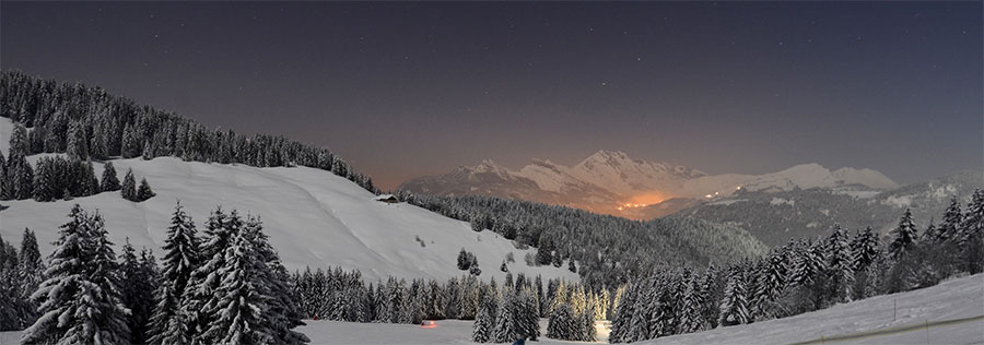
You can ski by the light of the Full Moon in La Clusaz, France this coming Saturday
J2Ski Snow Report 1st February 2018
A quieter, milder, week in the Alps with a bit more snow (and cold) incoming.
This Week's Snow Headlines
- A quiet weather week in the Alps to end a stormy, snowy January.
- Most snow in Europe this week in the Pyrenees and Scandinavia.
- Intense snowfall expected in parts of Eastern Europe.
- Up to a metre of snow in Iran after a snowless start to the season there.
- Volcanic activity threatens second Japanese ski area.
- More heavy snowfall in Northwestern North America.
- Thaw hits some Scottish ski areas.
Conditions in the Alps have stabilised a good deal after nearly a month of snowy and stormy weather.
Resorts that were still cut off by avalanche danger a week ago are now accessible again and have all or almost all of their slopes open again - most reporting great conditions - after the snowfall stopped, the sun came out and the avalanche danger reduced over the past week.
There have been big snowfalls in Norway and the Pyrenees, particularly the French side, got a lot of snow at the weekend. Scotland has seen a thaw, followed by cold and snow, all in the past week.
It has turned more unsettled in North America too with some very big snowfalls in the continent's north west and improving conditions further south and more snow in the East too.
Huge snowfalls in Iran and China, the former particularly welcome as ski slopes had been barren there until this week. Japan continues its snowy season too but with the unusual addition of increased seismic activities at the resort of Zao; with tremors and a 'volcanic danger warning' following the eruption at another ski area last week!
In the Alpine Forecast
Widepsread snow is expected across quite a wide area of the Alps today and tomorrow, with some heavy snow expected for Eastern Europe (and North East Italy). Settled - and cold - weather, with occasional light snow, is then expected to prevail for much of the next week.
Further snows are indicated in about 10 days time, but that'll be clearer next week.
See when and where it's going to snow...
Re-publication :- our Snow Report Summary, being the text above this line, is free to re-publish, but must be clearly credited to www.J2ski.com with text including "J2Ski Snow Report" linked to this page - thank you.
EUROPEAN ALPS
Austria
Conditions are good across Austria. Most resorts have enjoyed sunny days over the past week, the only real negative was temperatures getting a little too warm at the weekend and start of this week, particularly at lower elevations. It's colder again now though and fresh snow is expected towards the end of this week with moderate falls of 10-15cm a day adding up to 25-35cm by Sunday. Resorts in the far East of the country, like Nassfeld and bad Kleinkirchheim may get substantially more.
Snow depths are very good across most of Austria – a large number of areas have more than 3m snow depth and several more than 4m, the Dachstein Glacier topping the table at 5.5 metres. Most others have at least 1.5m on upper slopes, of the bigger resorts St Johann in Tirol is posting the lowest numbers but still good enough at 50-70cm.
France
Little or no fresh snow and sunny skies have been the order of the day in the French Alps over much of the past week. Conditions have been close to perfect on piste and even off piste more terrain has become accessible to knowledgeable local guides as the avalanche danger has gradually lessened. The exception has been down in the French Pyrenees (see separate section) which had a snowy weekend.
February looks like it will start snowy though, for one day at least, with up to 30cm/a foot of snow expected on Thursday in many French Alpine resorts, but then, if forecasts are correct, nothing much more on Friday or Saturday. Base depths are excellent across most French ski areas. The deepest is 455cm (15 feet) at La Rosiere but many other resorts have 3m/10 foot plus bases.
Italy
There's been no fresh snow in Italy either for the past few days, and very little this week. Here too conditions are largely very good, with plenty of snow from earlier falls from the eastern Dolomites to the Western Italian Alps and right down the Apennines too. With blue skies and light winds this is the kind of dolce vita skiing that Italians (and most other right-minded people) love.
Cervinia continues to have the country's deepest base, just shy of 4 metres, but as with the leading ski areas in the other 'big 4' European skiing nations, base depths are good across the country. Snow is in the forecast, but mostly for the western half of the country with up to 50cm forecast for Thursday and Friday in the Western Italian alps. That said forecasters are expecting a huge snowfall around Slovenia in the western Alps on Friday-Saturday and that may catch resorts in Italy's far North east too with about a metre of snow predicted!
Switzerland
Swiss resorts too have enjoyed a largely dry, sunny week. Base depths are good, conditions generally excellent and as with much of the alps there'll perhaps be 20-40cm of fresh snow confined to Thursday/Friday so change over day should be fine on Saturday. Crans Montana seems to have suddenly checked their snow depth measuring – having claimed a base of 6.5m a little over a week ago, they've now revised that down to 4m – so there has either been a fairly catastrophic thaw or someone was loading the wrong stats. Engelberg, which has claimed the deepest base in the world for much of the winter however, is still up there on 6.25m – down 30cm on its peak but still 21 feet.
Eastern Europe
Some huge snowfalls are being projected for the end of this week in Slovenia in particular – more than a metre of snow could fall within 48 hours on some centres if the forecast models prove correct. That should be good news as a number of resorts in the region have been suffering from warm temperature leading to wet snow and a thaw. One brand new ski area in Romania, complete with top-to-bottom snowmaking embarrassingly had to close three days in to operations due to torrential rain and temps too warm for the snow machines to work according to reports.
Scotland
A bit of an East-West split has developed in Scotland with Glencoe and Nevis Range in the West holding on to most of their snow cover from the falls two weeks ago (and subsequent top ups) but the snow cover mostly melted away at Glenshee and The Lecht in the East. Glencoe still has about 80% of it terrain open, Nevis Range about 60%. There's been more fresh snow in the past 24 hours and The Lecht has taken delivery of its Snow Factory all weather snow making machine.
Pyrenees
The Pyrenees saw the biggest snowfalls in Europe at the weekend with resorts on the French side of the mountains reporting up to 60cm of fresh snow. There was less in Andorra (10-20cm) and on the Spanish side but conditions remain good here on the pistes, almost all of which are open with nearly all lifts operating too. Andorra slope depths are 110-160cm on upper runs now.
Scandinavia
The biggest reported snowfalls in Europe since the weekend have been in Norway where some centres have reported up to 40cm of fresh snow in 24 hours and 70cm in the past 72 hours. Voss, Geilo and Roldal are amongst the big snowfall winners of recent days reporting powder conditions. As is often the case it has been less snowy further East in Sweden and Finland but here bases are good and most runs open anyway.
North America
Canada
There have been some big snowfalls in the past 72 hours in western Canada with whistler posting 60cm (two feet) of new snow since the weekend. It's one of those reporting a base depth of more than 3m now, reaching 316cm – about 10 other resorts have passed that mark too. Inland BC and Alberta have seen smaller but still significant snowfalls too. Things are not so good in the East where snow depths are now around 30 – 90cm at most areas and there's been little if any fresh snow this week, but most are largely open. Tremblant in Quebec, the most visited in the East, has 77 of its 93 runs open for example with a 60cm base.
USA
A fairly snowy week in the US, with the Northwest seeing the biggest falls, particularly Mt Baker in Washington State, traditionally one of the world's snowiest resorts and now starting to build up to its usual number one position for global snow depth with over 2 metres of snow in the last 7 days taking its base up to 536cm. It's a still improving picture further south in the West with park City in Utah now up to 250 of its 350 runs open, so still getting there but getting better. There's been some fresh snow in the east too which has had a pretty good winter on the whole so far.
Join the conversation : Discuss this in the J2Ski Forum
This news item has been viewed 6,463 times.
Also on J2Ski :- La Clusaz Snow Forecast Ski Hotels Ski Hire Ski Holidays