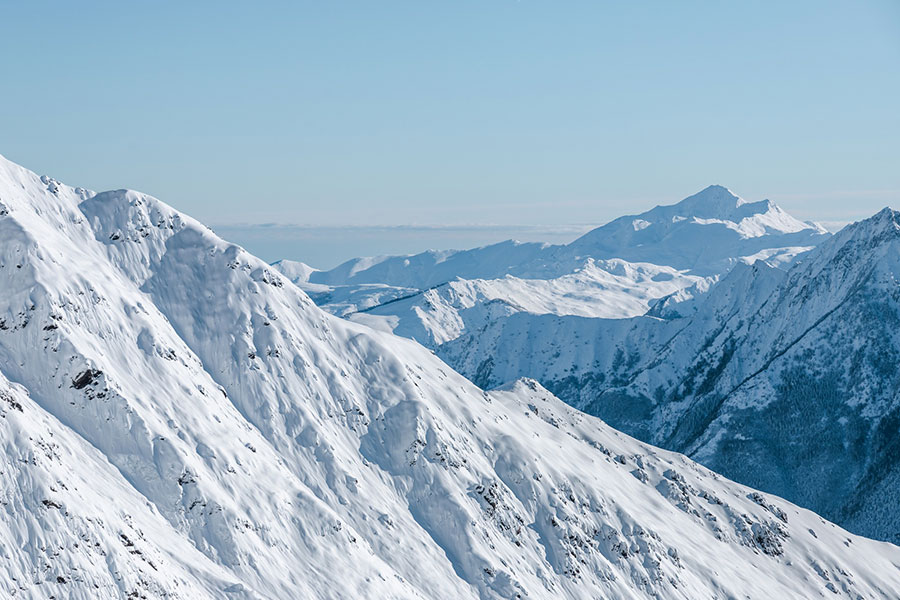
There's been a whole lotta snowing going on; this is the view from Cauterets, France.
Fabulous heavy snow falls across much of the European Alps, with some big snow in the USA and Canada too. Late season skiing is looking pretty promising across the northern hemisphere.
The Snow Headlines - February 29th
- Biggest snowfalls of 2024 arrive as forecast in the Alps - up to a metre reported.
- Two waves of snowfall arrive in a week.
- Europe's most northerly major resort Riksgransen open for 2024 season.
- Great conditions for much of North America after February snowfalls.
- Huge snowfalls in the Pyrenees allow the most terrain to open so far this.
- Avalanche Risk Levels rise to "considerable" across much of the Alps.
- Biggest snowfalls of 2024 in parts of western Canada.

That's a lot of snow in the forecast for Europe and parts of USA! Take the amounts with a pinch of salt, but it's going to snow...
Re-publication :- our Snow Report Summary, being the text above this line, is free to re-publish, but must be clearly credited to www.J2ski.com with text including "J2Ski Snow Report" linked to this page - thank you.
World Overview
It's been a big week for snowfall on both sides of the Atlantic.
The big snowfalls forecast for the Alps arrived, and in fact, there have been two major fronts move across in the last seven days, dumping more than a metre of snow between them on many higher slopes. So the perfect start to springtime in terms of a base boost.
There's also been a big snowfall down in the Pyrenees, which was very welcome there and it finally feels like the season is getting started, just as it enters its final six weeks...
It was quieter in North America until the past few days with a big fresh system moving in from the West Coast, bringing intense snowfall to the Pacific Coast and the Rockies, including a much-needed half metre to Whistler so far.
Europe
Austria
Austrian ski areas posted some of the biggest snowfalls in the world over the last week, with some of the heaviest falls claimed by ski areas in the south of the country (over a metre at Nassfeld and almost as much in Bad Kleinkirchheim) as well as up on glaciers.
The Stubai posted 90cm (three feet) of snowfall in 72 hours, the Kitzsteinhorn 75cm. But there was also snow for the larger but lower elevation areas like the Skiwelt and Saalbach-Hinterglemm, so everyone was happy to have had this boost in time for the start of spring skiing in March.
Temperatures have stayed cool and there have been more snow showers through the week. The coming week will see sunny spells and snow showers, with temperatures remaining low.
France
The biggest snowfalls of 2024 in the French Alps too with the 3 Valleys posting up to 75cm of fresh snowfall in 48 hours and Alpe d'Huez the deepest reported snow depth of the season so far at 4.8 metres up high.
Les Arcs says it has hit 485cm at 2,000m and notes that's about four times the depth reported a year ago at this point of the season. 50cm accumulations were widely reported through the weekend, causing some logistical issues on 'transfer day' Saturday as well as sending the avalanche danger levels up to 3.
The colder overnight temperatures also allowed snowmaking guns at lower elevations to fire up again at resorts like Morzine.
A second wave of heavy snowfall began on Tuesday and is continuing; it's since been snowing again, taking the 7-day totals past a metre in many areas.
More snow showers, potentially bringing another half metre are forecast through the weekend, then drier, sunnier conditions next week.
Italy
Italy received plenty of fresh snowfall at the weekend too, so much so that the World Cup Alpine ski racing planned for the Fassa Valley in the Dolomites on Saturday had to be cancelled due to too much snowfall; a little ironic after months of mostly dry, sunny conditions.
Across Italy, the snow was welcome, with falls of up to 60cm (two feet) reported on high slopes, 20-40cm at lower levels. Snow has kept falling through the week since, with a growing number of areas saying they've now had more than a metre, the heaviest on higher slopes of course.
Switzerland
Swiss centres got their share of the big weekend snowfalls with Davos and St Moritz amongst those posting over half a metre of fresh snowfall initially.
The weather has stayed colder and frequently snowy in the final days of meteorological wintertime since, with most areas picking up another 20-40cm of snowfall since Sunday, with sunny spells between. So much so that St Moritz is now posting a 102cm increase in its upper slope base depth since this time a week ago.
Avalanche danger is up as freeriding resumes but most centres have reopened all of their terrain after temporary closure during the heaviest falls. The new snowfall has not made a huge difference to open terrain, which was "most of it" anyway, but has improved piste quality down to low levels.
As with elsewhere in the Alps, more snow is forecast through the weekend, easing into more sunshine next week.
Scandinavia
Scandinavia has had another week of cool weather, with temperatures in the +5C to -15C range. Most of the region's ski areas remain fully open and have seen their bases increase with light to moderate snowfalls this week.
Europe's most northerly major ski area, Sweden's Riksgransen, opened for its 2024 season, which runs to mid-May, at the weekend.
The thickest snowpack is, as usual, on Norway's western coast where depths have reached 2.4m (eight feet) at ski areas around Voss. However, the largest open areas are at the biggest resorts like Sweden's Are, which reports a 1m snow depth and 90% of its slopes open.
The forecast is for more snow showers into the weekend, with temperatures staying low, but a degree or two warmer than last week.
Pyrenees
It's good to be able to report that we've had the best snowfalls of the season so far in the Pyrenees with centres reporting up to a metre of fresh snow on higher runs. That's as much as some have had all season combined.
Skiers and boarders have been able to head off-piste and enjoy fresh cover for the first time in months.
It's not yet made a huge difference to what's open (typically 50-70% of the slopes at larger centres), but several big areas including Spain's Formigal and Andorra's Grandvalira have promised they'll be almost fully open for the first time this season from the coming weekend.
Ordino Arcalias is the first ski area in the region to reach a 1-metre base and is 80% open.
The week ahead looks to be remaining cooler than it was in February with more snow showers forecast, if not so heavy as earlier this week.
Scotland
Scottish centres have had their usual battles with mother nature with mixed results.
Glencoe is in the best shape with about half its terrain open and top to bottom skiing. It had probably the best days of the season so far at the weekend with clear skies and still weather for beautiful blue sky conditions.
Elsewhere, Nevis Range hasn't enough natural snow to open and there's much more limited terrain available at The Lecht, Cairngorm and Glenshee.
There's been more snowfall, (along with lift-closing gales on Thursday) and there's more snow forecast, most promising for higher slopes.
Eastern Europe
Bulgaria has had some fresh snowfall this week, but just a few centimetres up high. Conditions remain best at altitude although Bansko has managed to keep its long run down to the town open, despite warmer weather in the valley.
In the Czech Republic, Slovakia and Poland, the best of the snow is also on higher slopes.
After some snowfall at the weekend, slopes have had a good refresh, but lower runs are not in such good shape with warmer temperatures impacting them; some lower runs are closed now.
North America
Canada
Temperatures are finally colder in western Canada and snow has been falling.
There was excitement along the British Columbia/Alberta border, where ski areas around Banff and Jasper as well as Kicking Horse and Panorama in BC posted up to 29cm of fresh snowfall in 48 hours, giving a powder day.
There was not so much to cheer about further west until Wednesday when Whistler Blackcomb reported it was finally below freezing to the valley and had a 48cm snowfall in just 12 hours. The snowfall was also good news for smaller, lower areas of Western BC surrounding it, which until now had either been closed completely or had just 10-30% of their slopes open due to the warm/dry weather.
It's been much colder and the snow is in better shape on the East Coast where ski areas in Quebec have again seen lows touching -20C over the last week. The forecast is for the west to stay cold, but unfortunately, the East will see warmer spells.
USA
It was a colder, snowier week than expected across much of the US with resorts posting up to 30" (75cm) of snowfall through the week.
As a result, conditions continue to be some of the best of the season so far in many areas – the exception continuing to be the Pacific Northwest Corner which continues to miss out on the significant snowfall and cold temperatures needed. With only a month of the season left for many areas there, it looks like if anything does arrive, it may be too late now.
Park City by contrast continues to post one of the world's deepest snowpacks, now at 3.3 metres, and is 100% open, the largest area in the US. Fellow Utah area Alta has the North American continent's deepest snowpack at 3.8m.
All that being said, a huge fresh major storm system is moving in from the Pacific as we complete this week's report, promising some big fresh snow totals in the west (up to 12 feet/3.5m+ by the start of next week). This should bring snow into the Pacific Northwest too, it's hoped.