
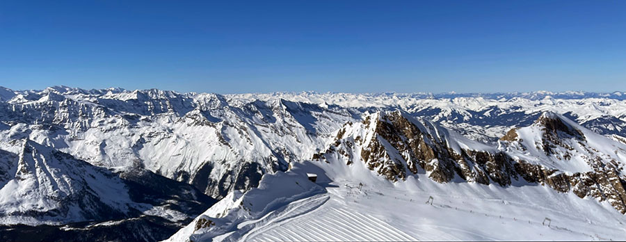
Snow and sunshine on the Kitzsteinhorn, Austria this week
Winter coming back to The Alps? Yet more snow in the US
The Snow Headlines - 17th February
- Sunshine dominates across the Alps and temperatures rise too.
- Snow still falling in the Rockies – up to 22" (55cm) in 48 hours reported.
- Avalanche danger mostly down to low (1) or (2) but still at 3 in the Arlberg region.
- World's deepest snowpack, at Mammoth, dips back below 6 metres/20 feet.
- Snow in the forecast (at last) for The Alps.
Snow coming, all over the northern hemisphere!
Re-publication :- our Snow Report Summary, being the text above this line, is free to re-publish, but must be clearly credited to www.J2ski.com with text including "J2Ski Snow Report" linked to this page - thank you.
World Overview
The Alps have seen a week of sunny skies almost everywhere and since the weekend temperatures have risen to double figures in the afternoons at low-lying resorts below 1000m, as the freezing point has climbed to 3,000m at the warmest part of the day, before dropping back down to valley floors overnight.
The upside of this weather is that you can enjoy sitting out on the terrace, and the avalanche danger has typically dropped to a low 2 or very low 1 on the scale in most parts, but then there's not much off-piste powder left to be found. The snowpack is slowly thinning but so far not at a rate alarming enough to lead to many slope closures with most resorts posting 80-90% of slopes open still, with little change on a week ago. That's particularly important given the half-term crowds.
Not much fresh snowfall to report over the last seven days anywhere else in Europe either. The Pyrenees have been predominantly sunny, it's been warmer in the Balkans and even Scandinavia has had less snow in the last week, although it continues to have the most fresh lying. Scottish centres are engaged in their usual battle to open much terrain against the elements.
Over in North America, there's been plenty more snowfall in the Rockies and Pacific Northwest but we're back to warm temperature spikes with some rain reported in the East and Midwest.
But snow may be back on the menu for Europe by the middle of next week... with forecast models now strongly hinting at a dip in temperature - and snow!
Europe
Austria
Conditions are probably the best in the Alps in Austria at present after ski areas there posted up to a metre of fresh snowfall during the first week of the month when most other areas further west stayed dry.
Most centres are (more or less) fully open and it is here that more fresh snowfall is expected over the weekend, albeit not in huge quantities. Otherwise, it has been the same predominantly non-stop sunshine picture enjoyed across the alps this past week, with temperatures rising to double-digits at lower elevations as the freezing point climbs to 2500-3000om – above the top at most Austrian ski areas – during the afternoons.
France
French ski areas have seen a warm and sunny week and for some resorts in the northern Alps, we're coming up to a full month since the last recorded snowfall. For Morzine that anniversary arrives on Friday; for Meribel on Sunday ...with not much chance of any change before then or indeed until next week.
But everywhere remains open, the FIS Alpine Skiing world championships look like they'll get every race staged without any weather problems (very rare even for a weekend of competition, let alone a fortnight) and the big ski regions like the 3 Valleys and Portes du Soleil remain 85-95% open with Tignes/Val d'Isere still posting Europe's deepest snowpack up top (2.7m / 9 feet).
Italy
A very similar picture for Italy to the rest of central Europe – warmer temperatures and lots of sunshine. But here too the warm afternoons are not yet causing much thawing so centres remain largely fully open, or nearly so.
Some snowfall is expected in the eastern Italian Alps and Dolomites around Sunday/Monday and temperatures should dip a little too, but it isn't expected to be significant falls, hopefully, a good refresh though.
Switzerland
Swiss ski centres have seen plenty of sunshine and warmer temperatures as well, like the rest of the Alps.
Some resorts with a sunny orientation like Crans Montana, St Moritz and Wengen have seen their bases, at resort level at least, thaw away, but snow cover on ski runs has been maintained and most still have 80-95% of their terrain open. Glacier 3000 near Gstaad even reports it still has some powder up high, for those venturing onto its freeride terrain.
Scandinavia
The snow has kept falling in parts of western Norway and up in Finnish Lapland, but there have not been the big dumps of recent weeks and base depths have not overtaken those of the Alps quite yet, as would have been the case had the snow kept falling at its previous rate. Nonetheless, centres are fully open, the snow among the deepest and freshest in Europe at present, and the daylight hours getting ever longer.
Pyrenees
Similar conditions to the Alps further north with warmer daytime temperatures and plenty of sunshine. Bases in the Pyrenees are quite thin so we've seen a small drop in the amount of terrain open at big areas like Andorra Grandvalira (Pas de la Casa, Soldeu and others) compared to a week ago, although they still have most of their runs open.
Scotland
The usual Scottish weather rollercoaster continues with some +10C afternoons then some sub-zero, snowy weather. But for the Scottish and Northern English half-term week coming up, there's not much open – a mix of high terrain not suited to beginners and short nursery slopes using all-weather snow machine snow for learners by centre bases.
Eastern Europe
After some of the big jumps in snow depth stats from Bulgaria to Poland the week before last, it has been a largely sunny picture across the region here too. In the Balkans, the gains have allowed most centres to now almost fully open their slopes, up in countries like Slovakia, likely to see fresh snowfall this weekend, centres like Jasna had already been 100% open.
North America
Canada
Generally, good conditions in Western Canada continue. Whistler remains 100% open and reports another 30cm or so of snowfall in the past week – its upper slope cover is now more than two metres deep.
Further inland, temperatures are in the freezing to -20C range and there's been plenty of fresh snowfall here too.
In Quebec, temperatures have been getting a little warmer as they were occasionally before the big freeze earlier this month, but the overall picture is good with everything open and mostly sub-zero temps.
USA
There have been some big snowfalls – 12" (30cm) in 24 hours, 18" (45cm) in 48 hours - reported at ski areas in the Rockies and Pacific Northwest regions of the USA; Jackson Hole, Taos and Telluride are among the resorts posting big fresh snowfall totals.
A bit drier further south on the Pacific coast though and Mammoth Mountain which hit a 6.6m (22 foot) base a month ago and remains the only resort to post a 6m+ base this winter, is now down to 599cm.
Conditions are generally good in the East with most areas fully open after the recent cold and snowy spell, but warmer temperatures have returned bringing the same problem of December and early January – rain showers rather than snowfall – at times.