


National avalanche bulletin
for Thursday, 30 October 2008
issue date 29.10.2008, 18:30 hours
Considerable avalanche danger above approximately 2700 m regionally
Current conditions
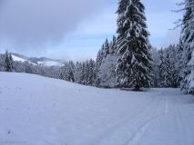
On Wednesday it continued to snow. The snowfall level on the northern flank of the Alps was 800 to 1000 m; in inneralpine regions, 1200 to 1500 m; and on the southern flank of the Alps, 2000 to 2500 m. Since the onset of this period of precipitation on Tuesday, it has snowed 80 to 120 cm above approximately 2500 m in the central part of the southern flank of the Alps. Elsewhere above approximately 1800 m on the central Main Alpine Ridge and in the regions on the northern borders thereof, 30 to 50 cm; on the remaining northern flank of the Alps and on the remaining Main Alpine Ridge, 15 to 30 cm; in the central parts of the Valais and in northern Grisons and the Lower Engadine, less than 15 cm. Moderate to strong southerly winds prevailed. Particularly in high alpine regions, easily transported snow masses are expected.
Due to the sunny and, in some places, warm autumn weather of recent weeks, there was very little snow in the Swiss Alps before the current snowfall. Old snow from the precipitation periods of September and the beginning of October was to be found mainly on north facing slopes above approximately 2700 meters and in high alpine glacial regions. This old snow was generally encrusted, yet in places it was also faceted. For that reason, the bonding to the new snow is quite poor in places.
Short-term development
On Thursday, the precipitation will subside. The following amounts of snowfall are still anticipated before Thursday midday: central part of the southern flank of the Alps and central Main Alpine Ridge, 30 to 60 cm; remaining Main Alpine Ridge, central and eastern parts of the northern flank of the Alps and western part of central Grisons, 20 to 30 cm; elsewhere 10 to 20 cm. The snowfall level will descend in northern regions to 500 to 800 m, in southern regions to 800 to 1400 m. Moderate to strong southerly winds will be blowing at high altitudes.
Particularly in high alpine regions, widespread snow transport is expected.
Avalanche danger forecast for Thursday
Northern Alpine Ridge from the Schreckhorn to the Glarus Alps; Main Alpine Ridge from the Mattertal to the Bernina Pass and regions south thereof; southern Surselva:
Considerable avalanche danger (Level 3)
The avalanche prone locations are to be found primarily on northwest to north to northeast facing steep slopes above approximately 2700 m. Particularly in places which were blanketed in old snow, slab avalanches can be triggered. Isolated natural avalanches can penetrate down to intermediate altitude areas. In areas below about 2700 m, the likelihood of slab avalanches being triggered is lower.
Remaining regions of the Swiss Alps:
Moderate avalanche danger (Level 2)
The avalanche prone locations are to be found particularly on northwest to north to northeast facing steep slopes above approximately 2700 m. In areas below about 2700 m, the avalanche situation is more favourable. Particularly in exposed places where there is a hazard of being swept along and falling, great caution is necessary.
The Avalanche Warning Service currently has relatively few detailed reports and measurements at its disposal from open terrain. Thus, the assessment of avalanche danger must be evaluated with particularly great care at each specific spot.
Trend for Friday and Saturday
In southern regions more snowfall is expected. In northern regions it will be generally dry. The avalanche situation is not expected to change much.
The next avalanche bulletin will be published on Thursday, 18:30 hours.
© 1998- 2008, WSL Institute for Snow and Avalanche Research SLF
could be some action over the next 48 hrs :D


