No real change in Europe - yet - and more snow in America.
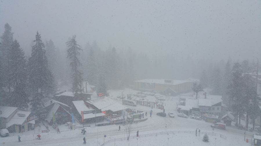
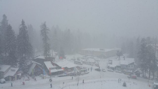
Borovets, Bulgaria - thanks to J2Skier Undermanager for the picture
This Week's Snow Headlines
- More big snow falls in North America.
- Up to a 40cm of snow reported in 24 hours to Wednesday at some Austrian ski areas.
- Fresh snow over Christmas in Canary Islands.
- Another 24cm of snow in 24 hours at Whistler.
- Scottish areas open beginner terrain.
It's unfortunately a case of deja-vu for regular readers of the J2Ski weekly snow reports with little fresh snow in Europe over the past seven days.
There has been some new snow though - a few inches here and there in the Alps, with some bigger falls blessing a few Austrian resorts, and more significant snowfall in Scandinavia and Eastern Europe. Scotland too, has had snow but it fell during five days of near constant gales and yo-yo temperatures.
North America, which was dry and warm in November when it WAS snowing a lot in the Alps, continues to see significant snowfalls as it has for most of the past six weeks whilst Europe has been largely dry.
Without wanting to sound like a broken record, the message for skiers heading to the Alps remains much as it has for most of the season so far; the November snow at altitude means that (at least compared to the previous two seasons) conditions are still not bad for December; with most slopes open and in good shape, albeit with almost zero off piste powder to be found anywhere.
In the Forecast
It does now look as if the High Pressure system dominating European weather is finally about to break down. Current indications are that much of the Alpine area will see a gradual transformation to unsettled weather over the next week or so.
There is some light snow in the near-term forecast, that should be enough to freshen pistes in most locations, but it's unlikely to be the off-piste game-changer we're all waiting for.
Looking further ahead, the forecast models are giving strong hints of a further turn to cold (and the potential for heavier snow) about a week into the New Year but that's outside the reliable timeframe of the forecasts for now.
Going Skiiing? Please send us a Photo Snow Report!
If you're in the mountains, please show us your snow! Check Snow Reports from Ski Resorts for a quick and easy way to send us pictures, straight from your phone.
Find a Ski Buddy or Group
You can now easily share your plans, and find others going to the same ski area. See Recent Ski Chat and follow the Who's Skiing Where, When link.
Re-publication :- our Snow Report Summary, being the text above this line, is free to re-publish, but must be clearly credited to www.J2ski.com with text including "J2Ski Snow Report" linked to this page - thank you.
The Alps
Austria
A dry Christmas week in Austria, in so much as snowfall is concerned, with only a few flakes reported up to Boxing Day but ending with slightly more substantial snowfall to parts of the country, particularly Salzburgerland and Styria. Several ski areas including Filzmoos, Flachau and Obertauern have reported 20-40cm of fresh snow in the last 24 hours. Snow depths are largely unchanged from a week ago – a metre or so on the glaciers and 50-90cm at most areas on upper runs elsewhere, thin-to-nothing-left on lower slopes at low lying resorts without snowmaking. But then most now have snowmaking.
France
A dry week in France and another dry week ahead according to forecasters with little or no snow falling since snow showers reached the extreme south east of the country's mountains in the week before Christmas.
Higher piste conditions continue to be relatively good at most of the major resorts however thanks to the November snowfalls and subsequent snowmaking. High altitude resorts have at least a metre on upper runs and 20-60cm at the base. Lower altitude traditional resorts like Megeve and Morzine lack snow at resort level at present and are still waiting for their first big winter snowfalls. Montgenevre, reporting 90cm at resort leve and 2m on upper runs claims some of the best snow in the country and the Alps.
Italy
Western Italian ski areas fared the best in the pre-Christmas snowfalls with some areas reporting up to 60cm of fresh snow and most getting at least 20cm. It has been dry over Christmas week, although there is the prospect of some light snow over the next week in places. Cervinia has one of the best snow bases in the country at 30-200cm but made world headlines for the wrong reasons on Christmas eve when over 100 skiers were trapped in a gondola that stopped in high winds. The numbers for the Milky Way area are also amongst the best in Europe with 50-150cm on the slopes.
Switzerland
Swiss resorts have had another dry week and there's been almost no snow here for six weeks now. The country was one of the major beneficiaries of the November snowfall however so up high things remain good on the pistes, down low most resorts have been able to maintain a ski run or two back to resort thanks to generally low temperatures although the valleys are green and brown. There are signs of changes ahead after the weekend with some fresh snow forecast. The volume is as yet uncertain with the most optimistic already forecasting several feet likely across much of the country, the more prudent suggesting it may only be a few inches although both extremes agree it should hopefully be something! Currently Saas Fee and Zermatt report the deepest snow in the country at just over a metre on upper slopes but about two thirds of areas say there's zero snow in resort and some like Davos have thin bases of 1-30cm.
Pyrenees
No fresh snow in the Pyrenees either and it could also do with some and may get some – 10-30cm forecast in the next week. There's currently around 20-25cm on lower slopes at resort level across the region and 40-60cm on upper runs but nothing fresh.
Eastern Europe
There's been up to 30cm of fresh snow reported since Christmas in parts of Eastern Europe with the Czech and Slovak Republics doing particularly well. Further south in Bulgaria and Romania there's been some fresh snow reported. Currently bases aren't bad with Bansko reporting the thinnest there at 20-40cm.
Scandinavia
Scandinavia has done the best for fresh snow in Europe again this week with some smaller areas in the north of Norway reporting up to 20cm a day for three days in a row since the weekend. Of the bigger resorts Hemsedal has had 15cm of fresh snow, but its base is down to only 20cm. In Finland and Sweden bases are at around 30-60cm. More snow is forecast for the region over the next week with 20-40cm for most areas.
Scotland
You have to admire the tenacity of Scottish ski area operators as they battle to try to open after mother nature threw yet another list of weather extremes at them over the past week. We can at least report that things are looking better than a week ago with slopes mostly white again rather than green and brown. But the snow arrived as temperatures varied between -2 and +12C over the Christmas period and the Highlands were battered by five days of non stop gales as successive storms (several of them big enough to warrant naming and bringing gusts over 100mph to Cairngorm) rolled through. Currently there's just enough snow at Cairngorm and Glencoe to open very limited terrain, and the coming week looks to see a mix of snow showers and temperature highs/lows again.
North America
Canada
Canadian ski areas continue to look good after more snow fell this week, topping up already very healthy bases and allowing continuing powder conditions across much of the country. Whistler Blackcomb has reported 24cm of new snow in the 24 hours to Wednesday morning and has one of the deepest bases in the country at 175cm. Conditions are very healthy on the East coast in Quebec too with 140cm including 12cm at fresh at the leading area of Mont Tremblant for example. The snow is expected to keep falling over the coming week across Canada.
USA
The US, like Canada, continues to revel in great snow conditions across much of the country since the 'warmest ever autumn' ended in late November and the snow started falling in abundance. It hasn't really stopped falling for a month at some resorts now with the snowiest having received more than 20 feet of snow so far this autumn/winter. Jackson Hole, Mammoth and Heavenly are amongst those reporting another foot/30cm or more of snow this week. Snow depths remain healthy across the country, including in New England where Stowe in Vermont for example has 50-100cm lying.