Messages posted by : admin
|
Hmm, tough to hit all three targets together... what's more important?
Obvious suggestions are :- Chamonix - nightlife to whatever level you want, likewise food, and various ski areas although the top lift at Grand Montets/Argentiere is out of action so the higher off-piste options are harder to access. Courmayeur - quieter nightlife but excellent for foodies! Smaller ski area but you do have the option of a descent from Mont Blanc on the Toula glacier (subject to snow conditions). Champoluc / Alagna / Monte Rosa - v.quiet nightlife, some excellent restaurants and a massive ski area with lots of off-piste options. In case you've not done Europe before; do be aware that any terrain outside marked runs is uncontrolled and you must assume it's NOT safe - so you will need full avalanche safety kit (and know how to use it). As you'll be new to the areas, do plan to get yourself a guide booked and you'll be able to access some amazing places! Once you've decided which area you prefer, there are quite a few trip reports on J2Ski and some of our forum regulars spend a lot of time in Chamonix and Monte Rosa so ask away! HTH |
|
More Big Snowstorms Arriving in the Alps, Dolomites and Pyrenees
Started by User in Ski News, 12 Replies |
|
You're a bit premature there. If you check the detail (https://www.bergfex.com/wildschoenau/wetter/prognose/#day0 vs https://www.j2ski.com/snow_forecast/Austria/Niederau_snow_forecast_48.html), both are forecasting the majority of the snow to fall this evening; Bergfex says 10cm top and 3cm town and ours says 10cm top and 9cm town - by midnight. Our forecast will update at least once more today, and I expect Bergfex's will - but maybe you can run outside with a ruler at midnight? 8) |
|
More Big Snowstorms Arriving in the Alps, Dolomites and Pyrenees
Started by User in Ski News, 12 Replies |
|
Nobody "randomly writes" the forecasts - they come, ultimately, from GFS. Where in the Tirol are you, and at what altitude? If it's raining in the valley, there's a good chance it's snowing on the mountain... For Niederau our forecast is currently showing 10cm for today (I think it's just updated and may have pushed some of the snow later in to tomorrow), with temps between -2C and +2C and snow line from 800m to 1000m; "Patchy heavy snow at altitude. Hvy shwrs below." The webcam on the Markbachjoch looks like this, right now :- 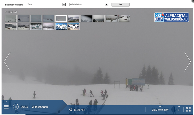
If you watch it live at https://www.tyrol.com/good-to-know/webcams-alpbachtal-region it appears to be snowing. If you check the other webcams around the Tyrol it looks like the kind of "patchy/showery" day that's very difficult to forecast accurately but - nonetheless - it's either snowing, right now, or looking like it's about to in various places. If you want to help us all out, as Jimbobilini kindly suggests, then please do - head up your nearest mountain and post some pictures and tell us what it's like on the ground.
|
|
|
J2Ski Snow Report 2nd January 2020
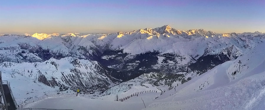
Mont Blanc, viewed from Les Arcs, France this morning. Happy New Year! There's snow in America, sunshine in Europe... The Snow Headlines - 2nd January - Sunny skies in the Alps after snowfall gives excellent New Year's skiing for most. - Heavy snowfall in Western North America - over a metre more in parts of Colorado. - Improving picture in Eastern Europe - colder temps and first snow of season in Romania. - Resorts in France and Italy post 4-metre base depths for first time this season. - Several avalanche deaths, unusually, on open pistes. - Scotland sees all-time high temperatures for late December - not good for skiing. - Snowfall at last in Japan - but some way to go before skiing normality returns. It has been a pretty good Christmas and New Year for much of the Alps following snowy weather in the run-up to December 25th. Sunshine has been dominant this week giving skiers glorious days on the slopes. Unfortunately, the recent mix of heavy snow, wind and warm temperatures have led to unstable snowpacks and several avalanches have crossed pistes in Italy and Switzerland in the past week. Off-piste Avalanche Risk Levels are typically at 3-4 (Considerable to High). The Pyrenees have not really seen any fresh snow this week and instead rather warm temperatures and sunny skies but centres are fully open for New Year week. It is also looking good in the Dolomites and up in Scandinavia. In Eastern Europe, it has turned colder and snowier so conditions continue to improve in Bulgaria with the snow being pushed lower and ski areas in Romania excited to have finally received their first snowfalls of 2019-20. In Scotland, it's a less exciting picture with warm weather bringing wet and windy conditions forcing centres back to small areas made with all-weather snowmaking machines. In North America, there have been more big snowfalls in the west of the country with some areas in the Rockies reporting more than a metre (three feet) of snowfall, and there are similar volumes expected through the first week of January too. It's less of a banner season, so far, further east but there has been some fresh snow here too. Over In Japan, there has been some snowfall in the north but temperatures are still hovering around zero so there's been rain too. It's looking like it should gradually improve over the coming week but snowfall totals are currently about half the average (or less) for the start of January. In the Alpine Forecast The current clear weather looks set to continue for another week, albeit with colder temperatures in the East this weekend, with less settled conditions from the 2nd week of January. 
Snow coming for Scandinavia and USA...
EUROPEAN ALPS Austria It has been a sunny week on Austrian ski slopes with great skiing for those lucky enough to have been on the slopes there over New Year. There's been little fresh snowfall reported, just a few inches here and there, but there is now a front moving in which should deposit 15-30cm of fresh snow to refresh slope cover at the end of this week and into the weekend. Most of the country's big ski areas are almost fully open, with the Arlberg region (St Anton and Lech) reporting more than 250km of its slopes now open, the Skiwelt (Including Soll and Westendorf) more than 200km. France It has been a good week to be on French ski slopes with mostly sunny conditions (although there was some fresh snow to end last week at Val d'Isere), temperatures hovering a little below zero and pretty much every slope open and every lift running. The only real complaint anyone has had has been that with such good conditions on the groomed runs there's a lot of people on the slopes and forming queues for key lifts. It traditionally gets much quieter as of next week though after the New Year holiday. France has also leapt to the top of the 'deepest base in the world' table with Val Thorens apparently re-measuring its depths and publishing stats of 384-412cm for the start of the new decade. Italy There's very little change in the stats from Italy's ski areas as after a snowy period up to Christmas it has been largely dry and sunny over the past week across the country from the western Alps to the eastern Dolomites. Base depths remain pretty good – as deep as 3 metres (10 feet) at resorts like Cervinia and Madesimo and even 4 metres at Passo Tonale. Most slopes were open for New Year and long lift queues were reported in some areas. The week ahead looks to be staying largely cold and sunny although with some light snow expected at the weekend, heaviest on Sunday at most areas – but probably still not that heavy. Switzerland Swiss resorts, like much of the rest of the Alps, have had a great few weeks after the pre-Xmas snowfall, with mostly sunny conditions, but cool temperatures and almost every run in the country open. There was a little fresh snow (10-30cm) for a few resorts in the west of the country to end last week but mostly it has been wall to wall sun and should continue like that for the next day or so before things get a little snowier to end the week with 10-30cm more in the forecast mirroring the week previous. Andermatt has now posted a 4m base depth, the first in the country to hit the four-metre mark this winter. Scandinavia It's looking pretty good up in Scandinavia too. The last day of 2019 saw accumulations of up to 25cm in 24 hours in Western Norway and parts of Sweden. The majority of the region's bigger resorts are fully open (or in the case of the biggest, Sweden's Are, about three-quarters open), with cold temperatures and decent snow depths. The start of 2020 here looks to be more of the same – cold and frequently snowy! Pyrenees It has been a mostly dry week in the Pyrenees with no fresh snow to report and indeed temperatures have been creeping up above freezing, particularly down in the valleys, since Christmas, with either clear sunny skies or light cloud. This isn't much of a problem so far as although slopes are now hard-packed and there's little off-piste powder to be found, the good snowfalls of November and earlier In December mean most areas have decent base depths and indeed most in Andorra are 100% open for the busy New Year week. Scotland Alas, the weather has not been kind to Scottish ski areas since Christmas with the forecast low temperatures a week ago failing to happen and instead we saw record high temperatures in the far north of Scotland with temperatures well into double digits above zero. So the past few days has seen centres only really able to open small areas for beginners and snow play using flake ice 'snow' from their all-weather snowmaking machines. Glenshee does have some longer trails still open however. It currently looks like temperatures should be dropping again and it is possible some of the precipitation forecast may fall as hill snow but sadly it might also be rain if it doesn't get colder. Eastern Europe It is an improving picture in Eastern Europe where a few weeks ago only a few higher altitude areas were open. Romania saw good snowfalls around Christmas Day. In Bulgaria, Borovets was finally able to open some terrain at Christmas and declared it was fully open for New Year. The snowfall has stopped but it has been bitterly cold so snow-making systems have been operating on max. North America Canada It was a fairly dry week in Canada after all the snowfall over the Christmas period. A storm system in the East led to some ski area closures although unfortunately, that was more freezing rain than too much snow. Another major storm system is now moving into the west of the country which is expected to deposit large amounts of powder on Alberta and BC ski areas. It's here that conditions have been the best in the country so far this season. Whistler, which has had a poor start, has at least had some snow (and is forecast to get much more this week) and now has about a third of its trails open compared to only 10% just before Christmas. USA It has been another very snowy week in Western North America with some resorts in Colorado posting over a metre of snowfall in the past seven days. Silverton Mountain has moved to the top of the "deepest snow in the country" table with a 2.5-metre base depth. It's continuing to snow hard into the first week of the New Year too. Further East it's not so good, at least in the Midwest where unseasonably warm temperatures have led to resort closures. A better picture in New England and the wider East Coast where there's been some fresh snowfall to top up cover there. |
|
Flying to L'Alpe d'Huez next week, I have nowhere to stay.
Started by User in Find a Ski Buddy / Group Trips, 2 Replies |
|
|
It's not a peak week next week, so you should be able to find something.
Lots available for those dates, depending on your budget, from a quick search on booking.com Otherwise, try one of the independent chalets / chalet companies - I'd be amazed if there wasn't a room in a chalet available for you. Good luck; you'll score something! :thumbup: |
|
|
J2Ski Snow Report 27th December 2019
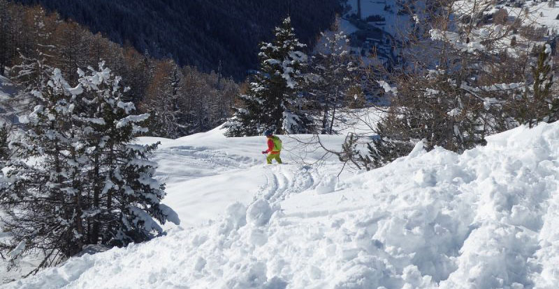
Thanks to J2Skier Sleekpony, for this picture; getting stuck in above Champoluc, Italy last week. More snow, but clearer days coming for Europe... The Snow Headlines - 27th December - Les Arcs and Tignes, high Alpine resorts report more than a metre of snowfall in 7 days. - Cold and snow at last for Eastern Europe; Borovets opens for the season. - Banff, Panorama, and other Canadian resorts report more than a metre of snow last week. - Swiss resort reports 1.4 metres of snowfall in 72 hours. It's been another very snowy period in the Alps from the start of last weekend through to Tuesday/Wednesday this week with huge accumulations reported at some areas, but most resorts reporting at least 20-40cm of snow and a good many quite a lot more. The big winners were higher ski areas with slopes above 2000 metres, with Les Arcs and Tignes both passing the metre mark on Monday. Many lower, traditional resorts also reported at least some snow down to the valley. There have been plenty of "mixed weather" issues, however - strong winds, sometimes warm temperatures, and occasional rain has affected the snow pack in some areas, and off-piste instability has resulted in high avalanche danger levels. On the positive side most resorts have been able to open most of their terrain and with the weather calming down over Christmas and Boxing Day skiers have been able to enjoy extensive terrain opportunities and good conditions at most resorts. It's a positive picture too in the Dolomites, Pyrenees, Scandinavia and even in Eastern Europe, which had been suffering from warm temperatures; many of the better-known resorts have had some good dumps too. In Scotland most centres are open and temperatures mostly low even though there's not much terrain skiable yet. Glencoe suffered a serious fire at the base station on Xmas Day, but was hoping to open for at least some skiing today. Over in North America, successive storms have hit the West of the country bringing huge snowfalls to Alberta and BC in Canada and along the Pacific Coast in the US. Less snow, but some, and generally good conditions in the Eastern US too. In the Alpine Forecast A clearing forecast for the Alps, with a warm few days for the western Alps, and colder weather to the East, with scattered snow - some heavy - today. Generally clear for the next week or so, with little snow in the immediate forecasts. 
Snow at last for Japan...
EUROPEAN ALPS Austria It's a very white Christmas in Austria with ski areas here seeing some of the snowiest conditions of the winter so far over the past week. The problem the country has faced with warm temperatures and little snow cover on low slopes has eased considerably with snowfall down to the valley floors this last week. Up high the snow depths just get better and better with glacier areas at or near 3 metre (ten-foot) bases. Generally, though Austrian ski areas are at least two-thirds open for Christmas / New year, making it officially a good season start. In the Arlberg region, for example, the snow is lying 60cm - 150cm (2-5 feet) deep and about 170km of the 300km or so of slopes there are open. France It's been a very snowy week in France with several resorts, including Les Arcs and Tignes, reporting more than a metre of snowfall in 72 hours over the weekend. Lots of areas now have more than 2 metres of snow depth on their higher lopes. It has eased off now although Les 2 Alpes reported another 30cm on Christmas Eve. Val Thorens, which has had more than 60cm (two feet) of fresh snow reports it has more than two metres of snow lying on its lower slopes, as well as its higher ones, so is looking good now for its season through to May 2020! Italy Italy too had a pretty snowy weekend, if not quite seeing the numbers reported over the French border. Base depths here include the world's deepest (4m) on the Presena Glacier and a number with around 3 metres (10 feet) lying including Cervinia. The latest snowstorms brought 20-60cm more snow over the weekend, the heaviest in the northwest of the country, but there's fresh cover almost everywhere and most Italian resorts are fully open (or nearly so) for Christmas and new year. Switzerland There have been some huge snowfalls in the Swiss Alps with Les Marecottes ski area reporting an incredible 1.4 metres of snowfall between Saturday and Tuesday and several other areas reporting more than 90cm (three feet) of snow in the same period. Here too conditions are generally great but the avalanche danger is also high. The Andermatt-Sedrun connection is now open with 30cm of fresh snow here and the resort reporting the country's deepest base at 350cm (nearly 12 feet). Scandinavia Finland, Norway and Sweden kept getting dumped on when the alps were dry earlier this month and not much has changed since it started snowing again in the Alps, except perhaps a little less heavy snow. But most of Scandinavia's slopes are in great shape under the floodlights during the darkest week of winter. Norway's Hemsedal reported a 20cm snowfall and powder conditions just in time for Christmas. Pyrenees It was a snowy few days at the end of last week and in to the weekend in the Pyrenees with several areas on the French side closed for short periods by strong winds and heavy snow. The consequence, once the storm passed, was of course still deeper bases and fresh snow. It's been mostly sunny since the weekend and unfortunately a little too warm (5-10 degrees above freezing) at times in places but on the whole, the picture is good with most terrain open and temperatures due to drop into the weekend with the possibility of more snow for New year. Scotland It can't be described as a vintage Christmas on Scottish ski slopes but at least all five Highland centres have some terrain open (assuming Glencoe managed to open today, after a fire there). This is largely thanks to all-weather snow-making systems all five centres now have. It has been mostly cold the past few weeks again and there has been some snow (and some rain) but several areas including Glencoe, Glenshee and Nevis Range have a few regular ski runs open too with so far thin cover. Eastern Europe Things have turned much colder in Eastern Europe at last and in Bulgaria, where it was double digits above freezing a week ago, it's double digits below now so the thawing has stopped and the snow-making machines turned up to max. There's lost ground to recover from the start of the 19-20 season but Borovets has now opened and Bansko has more terrain open although despite some fresh snow its base depth has dropped from 80 to 70cm since last week, presumably down to the warm temperatures before the snow arrived. No snow forecast at present but low temps so no more thawing and lots of snow-making. North America Canada It's now settled down at sub-zero across Canada, even on the East and West coasts which suffered an unseasonably warm autumn. The cold weather has allowed snow-making systems to fire up in Eastern Canada, where the start of the season proper is running late, whilst there have been some healthy dumps of snow on the west coast of BC, although resorts like Whistler Blackcomb are still way behind their usual snowfall totals for this point in the season. The good news there is a few feet more snow is forecast over the coming weekend. Inland in central and Eastern BC and over the border in Alberta, it's been a great season so far with tonnes of snow and more falling and forecast. Panorama and Banff have both had over a metre in the past week. USA Conditions are good across pretty much all of the US for the Christmas/New year holiday period. The last area that was suffering from warm/wet weather – the Northwest corner around Washington state and Oregon, has been dumped on over the past week leading resorts there that had delayed opening until now, to open at last for Christmas week. Elsewhere the main ski states – California, Colorado, Utah and Wyoming all look pretty good. There are a few that are still catching up after poor conditions in November and earlier this month - the country's biggest ski area, Park City in Utah, is only about a third open - but on the whole ski areas are offering much more of their terrain open. We'll be back with more detail on our usual Thursday slot next week... enjoy your weekend! |
|
|
J2Ski Snow Report 19th December 2019
Forecast snow accumulations (purple is lots!) to Sunday, courtesy of Ventusky Merry Christmas to you and yours; may it bring you snow in abundance! The Snow Headlines - 19th December - Over a metre of snow for some resorts in the Alps through last week. - Conditions impacted by weekend rain up to 1600m and strong winds at times. - Big snowfalls expected in parts of the Alps and Pyrenees to end the week. - Heavy snowfall in much of western North America (more than a metre in places). - Avalanche Risk Levels rise to 3 and 4 (of 5) with heavy snow, rain and wind. - Snow at last for Whistler Blackcomb but totals still down on usual averages. With the crucial Christmas / New Year fortnight upon us, and indeed the start of 'astronomical winter', the good news is that most of the world's leading ski areas are in great shape. Conditions do look good, especially above about 1800 metres, and much better than they have for Christmas week in several years recently. The deepest bases in the Alps are at 3-4 metres with most resorts posting at least 1-2 metres. There's been more snow in the past week and more is on the way to end this week. It's also looking good in the Dolomites, Pyrenees and Scandinavia and all five Scottish Highland ski centres have at least some terrain open. Travel! Heavy snow may cause disruption in places this weekend, particularly on Sunday, and early next week - be prepared and stay safe! Being the mountains, it's not complete perfection! The heavy snow last weekend was accompanied by gales and at times rain fell in the western alps up to quite high altitudes which rather made a mess of the fresh off-piste powder once it froze on top. It also set avalanche danger levels heading towards the upper end of the scale. Whilst most regions look good, a few less so. These include lower altitude areas in the Alps, where snowfall below 1500 metres remains limited, and parts of eastern Europe where temperatures have crept up to double figures above zero this past week – not good for snow cover, snowfall or even snow-making. Across the Atlantic, there have been more big snowfalls for California, Utah and Colorado as well as snow in New England. It's a slightly mixed picture as the continent's Pacific Northwest region, home to Whistler Blackcomb, is way behind its snowfall averages with only 90cm so far this season and still has little terrain open, though there's more snow forecast. It's a similar picture on the opposite coast in Quebec, where it has also been too warm, though in the middle resorts in Alberta and western BC are having a great early season with tonnes of snow and low temps. The worst news is coming from Japan where the warm and wet autumn is dragging on and the long-awaited started of the standard snowy Japanese winter which appeared to be with us a week or so back has now stalled. In the Alpine Forecast 
Some big snow in the forecast for France...
EUROPEAN ALPS Austria It has been a little warm again down in Austrian Valleys with Kitzbuhel seeing temperatures above +10C, whilst up high the situation is reversed with -15C reported on the slopes. The weather has been sunny and it has not been so snowy in recent weeks as it has been further west, but the big November snowstorms continue to pay dividends as the country's glacier areas have snow lying 2-3 metres deep, whilst larger, lower areas like the SkiWelt, Saalbach Hinterglemm and Kitzbuhel have thinner cover (5-55cm at Kitzbuhel for example) but most of their runs and lifts open for Christmas. There's some snow in the forecast for Thursday to Saturday with 20-40cm possible but heavier falls are forecast for the south and east of the country and up on the glaciers. France A fairly good week for snow in the French Alps although mixed with the negatives mentioned in our intro – including rain reported to quite high altitudes and severe gales bringing blizzard conditions leading to FIS World cup racing being cancelled in Val d'Isere on Saturday. Henry's Avalanche Talks, based in the resort, say the avalanche danger is close to its highest level as a result. On the other hand, snow depths are great for the start of Christmas and most resorts have most runs now open and overall it is indeed one of the best French Christmas snow reports we've written for many years! There's some snowfall forecast for the French Alps in the run-up to the weekend with heavier snow forecast on Friday and resorts in the Southern Alps including Isola 2000 and Serre Chevalier likely to see the biggest falls. Italy Italy got some of the biggest November snowfalls and through December has been home to the deepest snow base reported anywhere in the world so far this season – 4 metres lying on the Presena Glacier in Trentino. December has not been so snowy in the country and other than some sizeable accumulations along the western border with France (Aosta Valley) last week, there wasn't a lot of fresh snow to report. That should be set to change over the coming 48 hours with Italian resorts in line for some serious snowfall with potentially 40-60cm of snow across a wide area and some resorts possibly seeing a metre of snowfall in total by Sunday – the biggest snow forecasts anywhere in the world in the Christmas run-up. Switzerland Conditions continue to look largely good in Switzerland and the country will be seeing more big snowfalls to end the week. Ski areas here saw up to a metre of snow in the two storms last week although it was reported to be raining in Crans Montana at 1500m on Saturday After a snowy start to the week and temperatures stayed above freezing. Very heavy snowfall is expected to hit central and Eastern Swiss ski areas to end this week with 50-60cm accumulations possible at resorts like Andermatt, St Moritz, Saas-Fee and Zermatt as we come into the weekend. There'll be snow in the West of the country too but more like 20-40cm here if forecast prove correct. Scandinavia Conditions continue to look good in Scandinavia with generally low temperatures and plenty of snow falling – albeit generally the fine Scandinavian powder that's great to ski but doesn't add up to much. The heaviest falls have continued to be along Norway's West coast where Voss has had several feet more snowfall. There's no sign of any change ahead with Beitstolen, also in Norway, forecast to get another 30-cm or so by Saturday. Pyrenees Conditions continue to improve in the Pyrenees with Vallnord now reporting base depths of up to a metre and that all 40+ lifts are operating. It's a similar picture across the mountains with plenty of fresh snowfall this week and more on the way – 30-40cm is widely forecast leading into the weekend with the heaviest snow expected on Friday. Spain's Baqueira Beret has the deepest base in the region at 1.7 metres (nearly six feet) and has virtually all of its terrain open with 160km of trails open. Grandvalira in Andorra, which has the biggest area in the Pyrenees, has about 80% of its runs skiable this season to date. Scotland It's beginning to look a lot like winter again in Scotland after the false start in November. Temperatures are still fluctuating a little but are generally staying sub-zero, or at worst only creeping a few degrees above freezing. There have been several moderate snowstorms and all five Highland area expect to be open this weekend in time for the busy Christmas holidays. There's not yet enough snow for most of the centres to open a large amount of terrain with Glencoe perhaps offering the most. All five areas have all-weather snow-making so the small sections of slope covered by these have the deepest cover and are often used for snow fun like tubing as well as beginner lessons and in Cairngorm's case at least a small terrain park. Eastern Europe A mixed picture across Eastern Europe as more areas open for the season here too. Alas, Bulgaria has had a block of warm air sat over it and temperatures in Bansko were in double digits above freezing earlier this week, although the resort still reports 10-80cm lying. It is getting colder, on the mountain at least and rain/snow is expected from Sunday. Elsewhere there has been snow further north and west in Slovenia, Slovakia, the Czech Republic and Poland although here too the best snow so far is up high. North America Canada Conditions have been improving across Western Canada. They were already good on the Eastern side of BC and in Alberta, but temperatures have finally dropped a little on the Pacific coast too, and there has been some natural snowfall. Inland it remains better though, with Revelstoke having had more than 3 metres of snowfall already this season and 25cm in 24 hours on Tuesday/Wednesday this week. Compare that to Whistler with less than a metre so far and still only a small part of its terrain open with Christmas looming. The good news is there's more snow on the way here – not yet enough to transform the winter but certainly enough by the weekend for a considerable improvement. It's a similar picture in the East at Quebec where many resorts have been struggling with warm weather and little snow too. Mont Sutton was excited to get 15cm on Wednesday morning and reports 6 of its 60 trails now open. USA Quite a busy weather week in the US with some huge snowstorms at the weekend in California, Colorado and Utah building bases there by several feet. Several resorts in California now report they've had more than 10 feet (three metres) of snowfall this season – much of it in the last three weeks after a mostly dry and warm November. All the snow has caused some operational difficulties and reports of avalanches at or near Park City and Steamboat resorts, the first resulting in a fatality, the second a rescue. There's also been an "Arctic blast" in the East bringing snow there. The Pacific northwest which had been too warm and wet up to now is now getting dumped on (the mountains at least). Mt Baker in Washington state, which is on average the world's snowiest ski area most winters but which had had very little snowfall to date, is on course to see huge accumulations over the coming week, forecasters believe. Until next week... have a great Christmas Day, safe travels and bon ski... |
|
|
Excellent mugshot! What's the snow like??? :lol:
|
|