


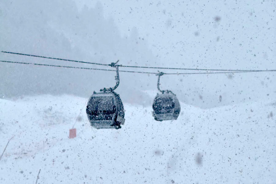
It's snowing across the Alps, this is Obergurgl, Austria...
This week sees the start of the French ski season, heavy snow and high avalanche risk in the Alps, and the mass opening of US resorts, with heavy snowfall also hitting North America's west coast and Japan.
The Snow Headlines - November 19th
- Warning of high avalanche danger as French ski season starts.
- US resorts begin opening en masse, some early although others delay.
- Heavy snowfall on parts of North American West Coast credited to Super El Niño.
- BC's season gets started at Whistler Blackcomb, but Sun Peaks delays.
- Skiing at Northern England's Weardale after UK snowfall.
- 4 Day Storm expected to deliver 1 m+/3 ft+ snowfall to Japan.
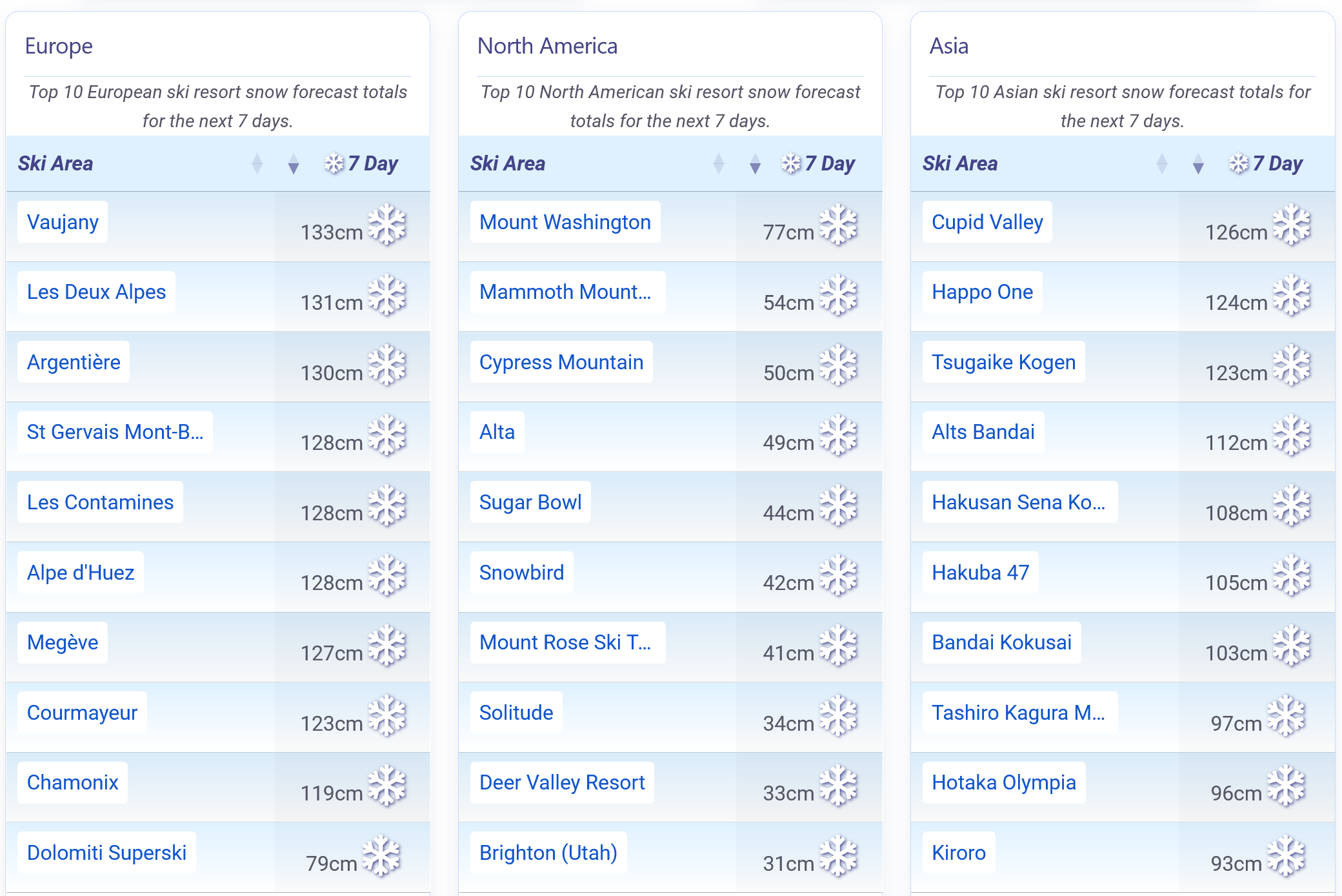
Heaps of snow in the forecast this week for Europe, Japan and North America.
Re-publication :- the J2Ski Snow Report Summary, being the text above this line, is free to re-publish, but must be clearly credited to www.J2ski.com with text including "J2Ski Snow Report" linked to this page - thank you.
World Overview
The start of the main ski season is edging ever closer, with the usual early runners and riders announcing earlier-than-expected openings or delays due to unfavourable conditions.
Conditions remain very fluid across the Northern Hemisphere, with most regions seeing below-average autumn snowfall and above-average temperatures. However, over the past week, major storms have hit the Alps and both coasts of the Pacific, bringing periods of heavy snowfall, particularly at altitude.
Unfortunately, mild spells have also featured, bringing rain as high as 2,700 m/8,858 ft. This has led to unstable early snowpack warnings in the Alps and Rockies, making it difficult to predict how much terrain will be open and how good conditions will be as we approach the wave of mass resort openings beginning the weekend after this.
The bigger picture is more promising, with the base-building accumulations forecast for the coming weekend being great news for the season start.
This weekend is a busy one. The French season is due to start, North America's largest ski areas are also due to open, and northern Japan and California may see up to 1 m/3 ft of snowfall from super storms linked to the El Niño peaking.
Other world snow news includes further snowfall on Scottish peaks, while Northern England's Weardale Ski Club became the first in the UK to get its lifts running after snowfall there. There is also novelty news that Kim Jong Un's daughter has been seen on the slopes at a new ski area in North Korea, suggesting it already has skiable snow too, although the photos were close-ups.
Europe
Austria
Austria has more than 10 ski areas open this weekend, with parts of Schladming's ski area, as well as Obertauern and Obergurgl, joining the country's seven glacier ski areas that opened in September and last month, plus Kitzbühel, which has a small amount of skiing open at weekends thanks to snow farming.
Obergurgl, or 'The Gurgls' to be more precise, will be the focus of world attention this weekend as the Alpine Skiing World Cup comes to town for its third stage. Sölden had up to 80 km/50 miles of slopes open at the weekend, so will presumably do so again this weekend (it is reporting 50 km/31 miles midweek – still the most in the world).
The weather has brought snowfall to glacier slopes this week but rain at lower elevations. Snow is expected to continue at lower elevations until Monday, when colder, drier weather arrives.
France
The 2026-27 French ski season is due to get underway this weekend, with Tignes and Val Thorens both set to open. It has been a dynamic few days, with significant snowfall above 1800 m/5906 ft, but also, on Tuesday, a warm spell that brought rain onto fresh snow as high as 2,700 m/8,858 ft. Further heavy snowfall followed, leading to warnings from avalanche safety agencies of high danger levels even before the season starts.
Continuing snowfall, and falling temperature, is expected through the weekend and into Monday, before drier, sunny but cold weather dominates early next week.
Italy
Western Italy has seen heavy snowfall over the past few days, with the Aosta Valley looking more like mid-winter than mid-November.
Cervinia, in particular, which is already open, has reported plenty of fresh snow, although strong winds and low visibility have been factors as the snow keeps falling.
Val Senales and Sulden are also open and looking good, with parts of Madonna di Campiglio's ski area expected to open next, this weekend, before the mass opening of Italian areas begins around the 28th.
The coming week is expected to bring heavy snowfall through the weekend in the west, with drier conditions but snowmaking-friendly low temperatures further east.
Switzerland
Switzerland will join Austria and the US in having more than 10 ski areas open this weekend, with Arosa and Pizol among those planning to start their 2025-26 seasons. During the week, only three areas are currently operating: Zermatt, Saas-Fee and Andermatt, with the rest reopening at weekends and aiming to switch to daily operations from 28th November or 5th December.
Swiss slopes have had a snowy week, with the freezing point dropping – a trend expected to continue through the weekend – bringing heavier snow and a lower snowline. There has also been rain at high altitude and gales at times. Snowfall has been, and will continue to be, heaviest in the south and west of the country.
Scandinavia
Things are looking more wintry across Scandinavia, with temperatures consistently in low single figures or below freezing. Most ski areas in the region now have white slopes, and some are reporting significant pre-season cover, particularly in Norway, with snowmakers fired up too.
Not much is actually open yet, just half a dozen areas each with a kilometre or two/around 1 mile of snow, mostly farmed from last season. This is not set to change much over the coming week, with the final weekend of the month seeing the opening of many of the bigger resorts in Norway and Sweden.
The forecast is for plenty of sunshine and low temperatures across most of the region.
Pyrenees
The Pyrenees remain in pre-season build-up, with no resorts open so far; the earliest is now expected to start on the final weekend of the month. There has been some snow at higher elevations, but the week ahead looks rather mild, unfortunately, with any snowfall likely limited to the highest peaks and reduced snowmaking opportunities.
Scotland (and England!)
Scottish ski centres have had fresh snowfall this week, with overnight lows as low as -8°C in valleys, and colder higher up. Although four of the five centres have all-weather snowmakers, two of which were upgraded this year, none are expected to open before December unless there is significant early snowfall, which isn't in the current forecast.
South of the border, Weardale Ski Club, near Newcastle, did open last week after snowfall on northern English peaks.
Eastern Europe
Other than a few areas opening small snow slopes thanks to all-weather snowmaking in Romania and the Czech Republic, the main season isn't expected to start in Eastern Europe until early December.
It's a mixed weather picture, with some good pre-season snowfalls interspersed with milder spells. The past few weeks have seen sub-zero temperatures and light snowfall on high terrain, with snowmakers also firing up, though there have been no significant natural accumulations as yet.
North America
Canada
North America's largest ski area, Whistler Blackcomb, is set to kick-start BC's season after a promising week of snowfall, heaviest at altitude with some rain at lower elevations.
Western Canada has seen good pre-season snowfall over the past month, particularly in BC, but there have also been warm spells, so opening conditions are marginal; some resorts have announced delays, including the country's second-largest, Sun Peaks. Marmot Basin, near Jasper, has also delayed by a fortnight but plans to open this weekend. Otherwise, there are just a few kilometres/a couple of miles of slopes open at each of Sunshine, Lake Louise and Norquay, with Nakiska opening at weekends.
Things are still moving slowly on the east coast, with milder temperatures than ideal for snowmaking, but Tremblant aims to open this weekend.
USA
A powerful and ongoing run of Pacific storms has given an early lift to the US ski season, particularly along the West Coast, where atmospheric river systems have delivered substantial precipitation to the Sierra Nevada and Cascades. As with the Alps in Europe, it has been a case of snow up high and rain at lower levels.
Mammoth Mountain picked up 40 cm/16 inches of fresh snow, allowing it to expand terrain and open additional lifts, while Heavenly, Northstar and Palisades Tahoe are all preparing to welcome skiers, with Palisades announcing an early start following significant snowfall.
In the Rockies, Colorado now boasts eight operating ski areas, matching the rest of North America combined, with Vail one of the latest to open; however, some, including Steamboat, have delayed, blaming mild weather.
Utah's season is finally underway after Brian Head received more than 45 cm/18 inches of snow. Further snowfall is expected across the western mountains through the coming week.
The east coast's season has also got underway, with marginal conditions as mild weather followed weekend snowfall. Big players Killington and Sunday River are among the areas opening a few runs each.