Messages posted by : J2SkiNews
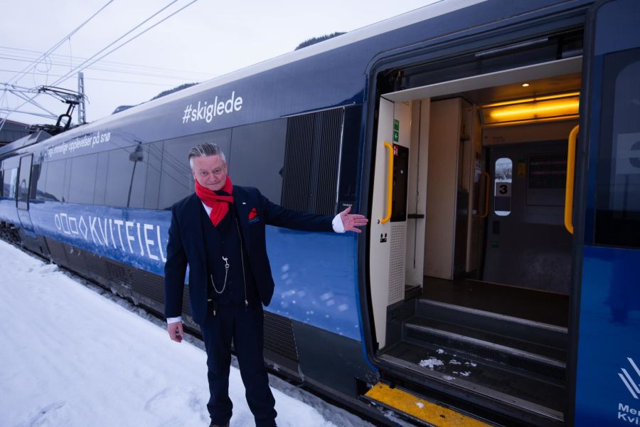
A ski train service between Norway's capital Oslo and the ski resort of Kvitfjell has had a new ski and snow themed branding to its exterior. 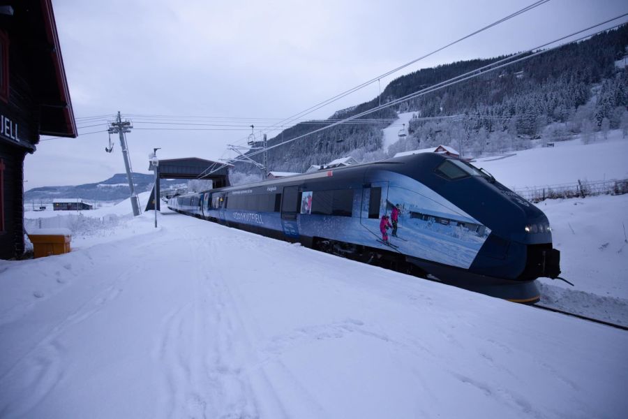
The train is now covered with ski and mountain scenes, as well as a picture of Norway's famous downhill ski racer Aleksander Aamodt Kilde. 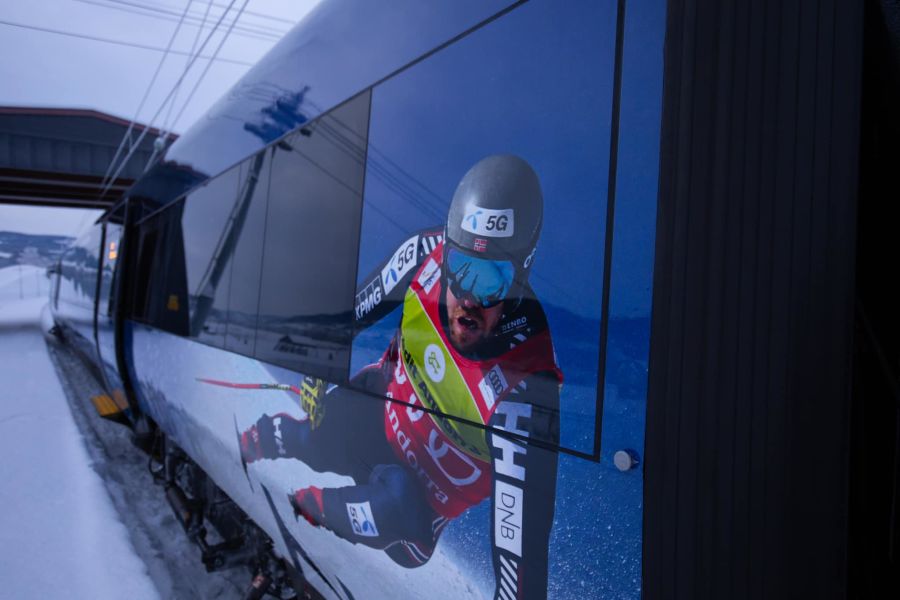
The train service runs daily from Oslo with connections from other Norwegian cities through the ski season. 
On arrival at Kvitfjell its possible to take a ski lift from by the station and at busier times including weekends additional shuttle bus services are laid on to other base lifts at the heart of the ski area. 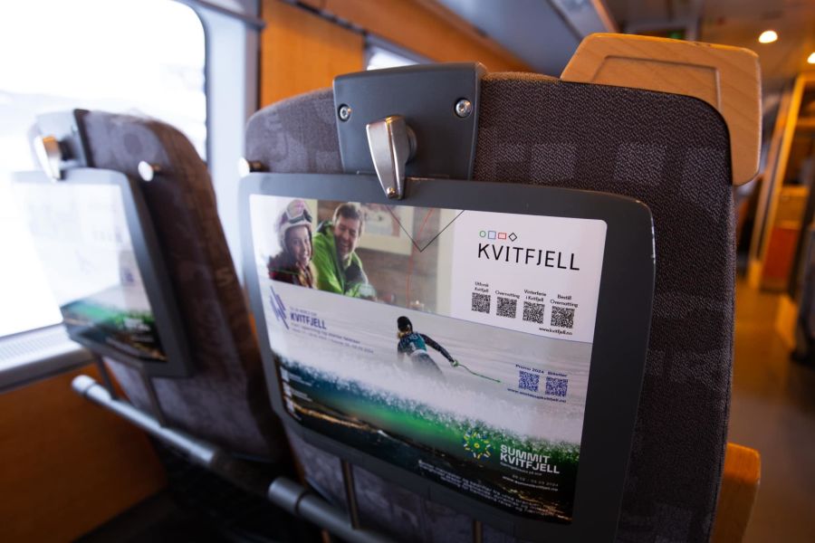
The station lies at the bottom of the World Cup Olympic downhill race piste built for the Lillehammer 1994 Winter Olympics – it's possible to ski back to the station but you do have to ski down the black-graded Olympic downhill to do so. 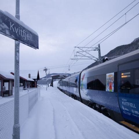
Travel times from Oslo to Kvitfjell station are from 2 hours and 45 minutes. From Oslo Airport it is 2 hours and 15 minutes (it is also possible to take the train from the UK and most other parts of Europe and Asia to Oslo). The connection from Trondheim to Kvitfjell station is just under four hours. 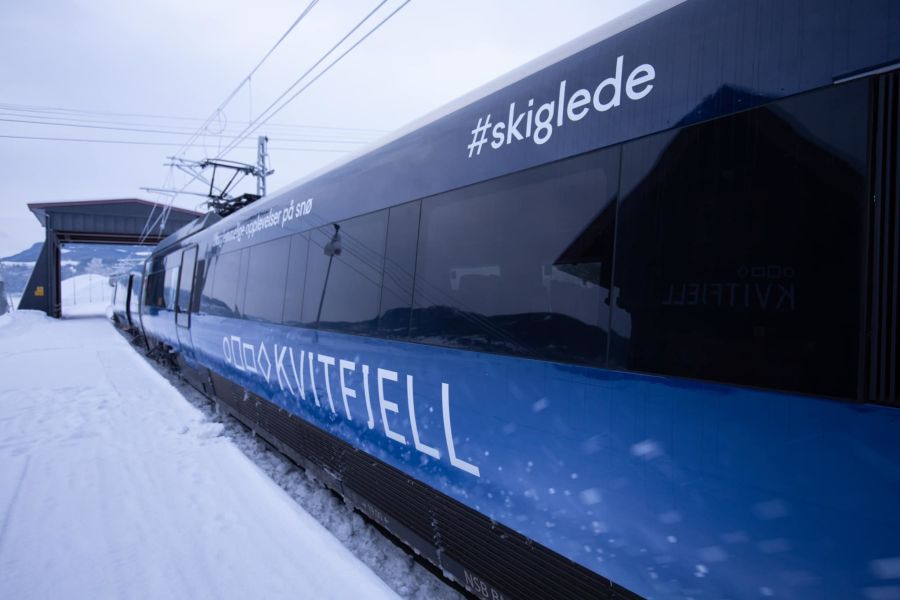
|
|
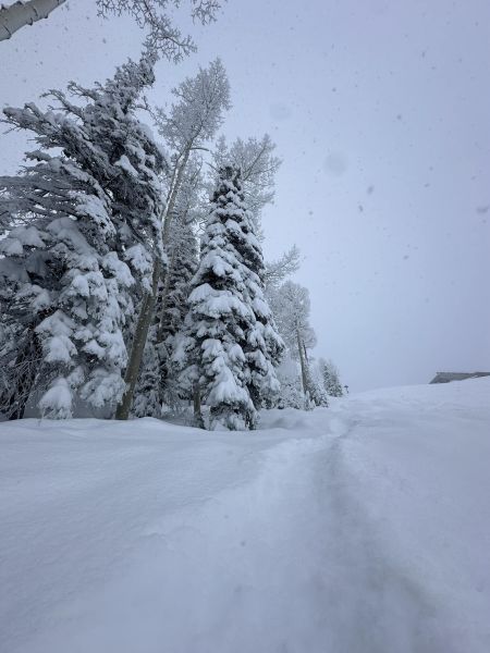
Heavy snowfall across North America have delivered "the first powder days of the season" to many resorts in the Pacific Northwest of the continent. Accumulations of up to 24" (60cm) in 24 hours have been reported by ski areas in Oregon, Washington state and in BC, Canada to the north. Further south and further in land there have been significant snowfalls too and another major storm system is just moving in. The snow is badly needed after a dismal first few months of the season with very little snowfall and temperatures too warm for snowmaking which left centres struggling to open much terrain over the key Thanksgiving, Christmas and New Year holidays. The poor early season conditions have been blamed on a very strong warming El Nino system this winter from the Pacific. Even with the new snow the snowpack remains well below the average for January and skiers and boarders have been warned to be cautious of 'early season conditions' and watch out for unmarked obstacles under the snow. |
|

Hot on the heels of Robbie Williams playing two successive nights of concerts, the Black Eyed Peas have been lined up to play Ischgl's famous Top of the Mountain season closing gig, this year on April 30th. The American hip hop superstars will follow in a long list of illustrious names to play the same concert that have included Kylie, Rihanna, Elton (twice), Katy Perry, Lenny Karvitz, Muse, The Beach Boys, Rod Stewart, Bob Dylan, Bon Jovi, Diana Ross, Peter Gabriel, Pink, Mariah Carey, Tina Turner, Deep Purple, Nickelback and Robbie Williams again (he played Ischgl in 2014). The Black Eyed Peas hits have included the famous anthem "I Gotta Feeling" as well as "Where Is the Love?", "My Humps", "Ritmo" and "Girl Like Me". Admission to The Top of the Mountain Closing Concert, which will start at 1pm, is included with a lift pass. |
|
Unfortunately it has arrived too late for the key Christmas and New Year holiday weeks, but Canadian and US ski areas are finally seeing what is for most their first big snowfalls and resulting powder days of the season so far. Ski areas in the Rockies posted the most snowfall, with 30-50cm (12-20 inch) totals for centres in Alberta, Colorado and Utah reported. Steamboat was one of the big winners, with Aspen and Snowbird getting over a foot of snowfall each. There has also been more snowfall on the East Coast where there's more snowfall forecast over the next few days. North of the border Whistler Blackcomb reported 42cm (17 inches) of snowfall and now has 75% of its terrain open, finally having the most available in North America, having previously been behind Vail and Park City which had had more terrain open until this recent snowfall. Although the snowfall is very welcome, the warm dry/wet first 6-8 weeks of North America's ski season means that on average snow depths are below half what they would normally be at this point in the season, and similarly less than half the country's terrain is open, so there's some catching up required. |
|
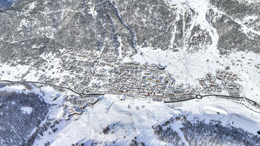
While snow levels are good across much of Europe and above average in the Alps, the Pyrenees have had a difficult start to the 23-24 season with mostly dry and often warm weather. Snow levels are currently at a third of what they should be, on average, at the start of January and ski areas have been struggling to open terrain. Many of the region's smaller areas are closed still, or just have a few runs open, while big resorts like Andorra's Grandvalira, which now encompasses almost all of the principality's formerly separate ski centres, has about 40% of its 240km of slopes open. There's some good news to start the new year though with snowfall arriving this weekend, ski areas on the French side of the mountains are reporting 20cm accumulations so far – the most of the season so far. Snowfall is expected to continue through the weekend with up to 30cm (a foot) forecast with more light snowfall next week. Temperatures will also be lower, with highs around freezing, lows down as far as -15C, so good snowmaking conditions. |
|
There's been fresh snowfall in the Alps as a period of more changeable weather follows what has been nearly a fortnight of largely dry and sunny weather. Montgenevre in France was among the first to report 20cm of fresh snowfall on New Years Day and subsequently many other areas have reported similar accumulations above 1800m. There have been concerns of rainfall to about 2000m as well, with temperatures on the tipping point between snow and rain. However, so far, impact seems to be minimal. Les Gets, one of the lower-lying resorts and ski areas that was suffering with no snow at all below about 1800m this time a year ago, reports 10cm of resort level snow overnight and 20cm high up. Webcams show (wet looking) fresh snow in valley. Neighbouring Morzine has so far reported 35cm of fresh snow and other low-lying traditional ski villages Chamonix and Megeve 30cm each. These stats will all be for their higher slopes. The forecast is for more rain, sleet and snow (depending on altitude) through today, then for more snowfall through the week ahead and into next week as temperatures drop. Avalanche danger has risen a little though from generally a fairly low 2 on the scale to a maximum 5 last week, to widely 3 ("considerable") now with expectations that this will rise to 4 as the snow showers continue. |
|
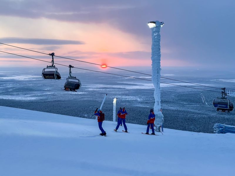
Finland's largest ski area, Levi, says its lifts will keep running to 11.30pm tonight, New Year's Eve, for anyone wishing to ski or ride in the New Year. The resort plans to start its party, including a big fireworks display, when the lifts stop running. New Year's Day has added significance for Levi as it will see the sun fully emerge above the horizon again at 12.19 for a few minutes after staying below it for a three-week period of polar night which began in early December. Levi has one of the longest ski seasons in the world for a non-glacier ski area. It opened for its 23-24 season almost three months ago at the start of October and will complete its seven-month season in early May. Through midwinter all skiing is under floodlights, but by the end of the season its close to 24 hour daylight. It's season began using over 100,000 cubic metres of snow saved from last winter, but there was fresh natural snowfall on top within days. |
|
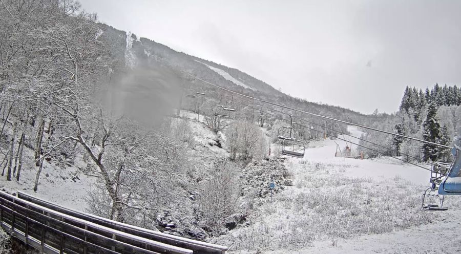
Fresh snowfall has been reported in Eastern North America after a Christmas week marred by periods of heavy rain. Maine's Sunday River (pictured above), which was one of those hardest hit by the rain, which damaged some infrastructure causing it to close for several days in the run up to Christmas, was one of those to see the most fresh snowfall on Saturday – around 10cm (4"). It is back up to 18% of its terrain open. Other mountains reporting similar falls included Cannon Mountain in New Hampshire and Sugarloaf in Maine. However conditions across the region remain dire compared to normal season with largest resort, Vermont's Killingon, only having 14% of its runs open and 30cm of machine-made snow on that for the peak New Year holiday period. The next few days look dry before more snowfall arrives later this week. Crucially temperatures are expected to remain at or below freezing with no more warm weather spikes that have marred the season in the region so far in the short-term forecast. |
|