Messages posted by : admin
Blimey. :shock: Must admit, we're struggling to keep up with this! I don't think I've ever seen snowfall like this in the 48-hour forecast in 10 years... 
For some of those locations, there's more forecast to fall tomorrow than fell today. For once, we're hoping for there to be rather less than predicted! |
|
|
Always check the piste map at the foot of the lifts to make sure there's enough snow...
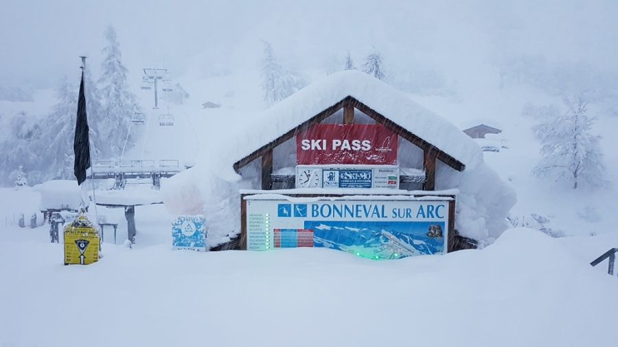
Photo from WePowder |
|
Hmm, looking like the period of calm will be 5 or so days once the current storm clears... un-settled weather to follow that, likely cold and snowy but probably (hopefully!) not on the scale of the last two storms. But it's getting silly now; Savoie have declared a "Red Alert" for avalanche danger this afternoon and, to add to what Swingbeep said, quite a few villages are now isolated (all roads closed) in the French Alps with numerous road closures around the region. In addition to the better-known resorts that now have the Avalanche Risk Level at 5 (Tignes, et al), smaller centres including Bessans, Bonneval-sur-Arc, etc. have reported huge snowfalls today and are effectively cut-off tonight. 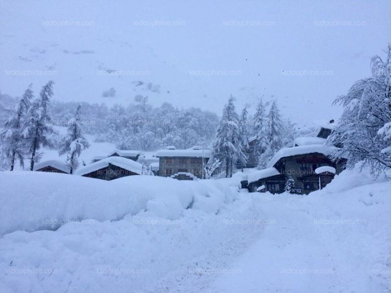
Bonneval-sur-Arc, photo from Le Dauphine's report here. |
|
Breuil-Cervinia Snow Reports - December 2017
Started by User in Snow Reports from Ski Resorts, 6 Replies |
|
They'll be staying inside until they're allowed out to look for their cars... 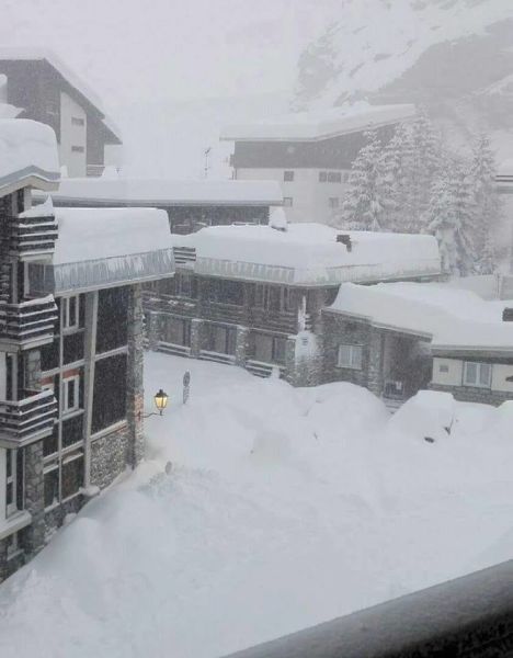
Picture courtesy of Severe Weather Europe's Facebook page |
|
Last Chance to Win this ace Suunto Spartan Sport Wrist HR Baro!
Started by User in Ski Deals and Competitions, 3 Replies |
|
A skier called Neil! |
|
|
Do you take the inners out overnight? If not, try that.
The boot-room dryer things seem to be everywhere now and they work for me - are they not sufficient? |
|
The "big picture" for the Pyrenees is interesting right now, have a look :- https://www.ventusky.com/?p=42.6;1.7;5&l=rain-ac If you select the accumulated precipitation and run the animation out, you can see Soldeu's almost at the centre of a calm between various weather systems right now. GFS then has you getting a quick 1-2 with an Easterly flow bringing it in on Sunday, followed by a switch to more from the West on Monday. Also clear on that animation is the build up of snow into the south side of the Alpine ridge (Aosta Valley and Dolomites) on Sunday/Monday with a Retour d'Est (big snow, but often quite localized) on the cards. More to watch! |
|
Fair point! :lol: ...but we had the better day... |
|